In order to survive, coral reefs and associated ecosystems such as mangroves, coastal swamps and lakes, need specific environmental conditions, such as low nutrient and sediment levels. These required conditions can easily be altered by the content and quantity of water that flows through watersheds and into coral reef waters. By effectively managing watersheds, Para La Naturaleza protects both the health of coral reefs and the people who depend on them. The strategies and actions of the CLME+ CSAP are aligned with the following projects and actions carried out by Para La Naturaleza:
Strategy 4: Strengthen civil society’s role to conduct and participate in research and monitoring for management of the coastal and marine environment
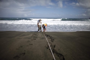
Quebrada Ceiba Watershed Coral Reef Health Monitoring Project –
In January 2019, Para la Naturaleza (PLN) was awarded a $140,000 grant from the National Fish and Wildlife Foundation to develop the Quebrada Ceiba Watershed Coral Reef Health Monitoring Project. The project established a goal of implementing a coral reef-health monitoring program with the support of community volunteers along the Quebrada Ceiba watershed. This monitoring program seeks to obtain data that could help implement actions to reduce excess sedimentation in water runoff towards the nearshore coral reefs found from Seven Seas to Medio Mundo y Daguao Protected Area. The project, through data collection and volunteer participation in the form of citizen science, will help increase knowledge and awareness of the connection between forests, rivers, and coral reef ecosystem health.
Coalición de Restauración de Ecosistemas Santurcinos (CRES) –
Para la Naturaleza (PLN) has been supporting the Coalición de Restauración de Ecosistemas
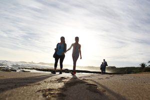
Santurcinos (CRES Inc., see also https://www.facebook.com/pg/crespr/posts/). Santurce, a San Juan neighborhood, is the coastal zone with the highest population density in the islands of Puerto Rico. Ocean Park, a residential and commercial area that suffered severe flooding during hurricane María, has 3.3 kilometers of sandy beaches, where we planted 469 trees suitable to this ecosystem, including cocoplum (Chrysobalanus icaco), seagrape (Coccoloba uvifera), and button mangrove (Conocarpus erectus).
Reforestation and Habitat Enhancement of Hacienda la Esperanza Nature Reserve in Manatí
In 2019, we started operations related to an award from the National Fish and Wildlife Foundation that supports the planting of 50,000 trees in the next three years (2019-2021). This project will change the ecological landscape in the reserve, since it will help create biological corridors interconnecting fragmented ecosystems while protecting the soil from erosion and the water from sediments. We have already planted 3,338 trees in the riparian forest at the María Hernández tidal channel, which connects the Río Grande de Manatí with the reserve, the coastal forest and the intertidal inland channels of the river. This reforestation project entails planting tree species adapted to wet areas, such as red mangrove (Rhizophora mangle), white mangrove (Laguncularia racemosa), pond apple (Annona glabra), button mangrove (Conocarpus erectus). Upland species, like the shortleaf Ffg (Ficus citrifolia), gregorywood (Bucida buceras) and maga (Thespesia grandiflora) serve as ecotone gradients (transition between two different ecosystems). We reintroduced some species to add biodiversity to the forest and promote its conservation. These species are the hat palm (Sabal causiarum), violet tree (Plebotaenia cowellii), West Indian satinwood (Zanthoxylum flavum) and zapote de costa (Manilkara pleeana).
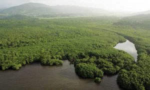
Pterocarpus Swamp Forest Reforestation, Dorado Puerto Rico
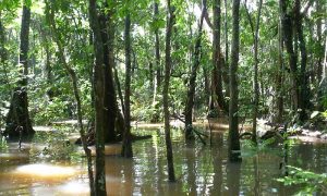
Together with other forest types and ecosystems associated to the Pterocarpus forest’s functional processes, the area as a whole is also known as the Dorado Coastal Moist Forest. Both the Dorado Pterocarpus Forest and the old secondary moist coastal forests that surround it are considered one of the most endangered forest ecosystems in Puerto Rico, and one of those most negatively affected by human activities. With high biological productivity, unique habitats, and stunning flowering plant species, the forest’s habitats are rarely found elsewhere.
Accessibility to the freshwater Pterocarpus swamp makes it an ideal location to demonstrate to the public the structure, composition, and complexity of his type of forest. It is close to important tourism attractions and amenities and can provide hands-on learning experiences for tourists and residents about these unique and endangered ecosystems.
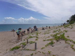
Hurricanes Irma and María caused severe damage to this protected swamp forest. After a private donation made by the Piovanetti family to restore the habitat, our team evaluated the damage and designed a course of action: 35 volunteers from the Dorado community planted a total of 250 trees of 15 different native species. The reforestation plan developed aims to enrich the composition and structure of the forest, remove invasive species and improve the habitat to achieve greater biodiversity of species.
Strategy 6: Develop and enhance sustainable livelihoods based on the use of coastal and marine resources and Strategy 7: Enhance communication to raise awareness and advocate
Restoring Deserted Agricultural Land for Migratory Birds in Santa Agueda
Two thousand trees were planted in this former sugar cane plantation in Naguabo, now part of Para la Naturaleza’s Humacao Nature Reserve. The project was awarded $140,000 from a US Fish & Wildlife grant for wetland restoration focused on providing habitat for neotropical migratory birds. Reforesta, Inc., a private corporation specialized in wetland restoration in Puerto Rico, was commissioned with the reforestation work. A la Cosecha, Inc. an organization of local farmers of the east of the island, carried out maintenance work for this project.
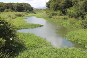
Mapa Madre unites four communities in the Rio Grande de Manatí
The Río Grande de Manatí headwaters start at the Toro Negro forest before flowing across nine municipalities – Orocovis, Barranquitas, Morovis, Ciales, Florida, Jayuya, Corozal, Barceloneta, Manat – before reaching the Atlantic Ocean. It is the third longest river in Puerto Rico. In the last two years, the staff of Hacienda la Esperanza has worked hand in hand with the communities surrounding the Río Grande de Manatí in many different projects and activities. In 2018, the Mapa Madre initiative emerged from the synergy between four communities located in the Río Grande de Manatí basin who share their love for the river. These communities are Amigos del Bosque Toro Negro in Orocovis, Toro Negro in Ciales, Bosque Cibales in Ciales, and Unidos por el Área Recreativa de Cialitos in Ciales. “We have made this alliance because we have the same goal of protecting this river basin”, said Edith Roubert González, community volunteer, Toro Negro Forest, Orocovis